-
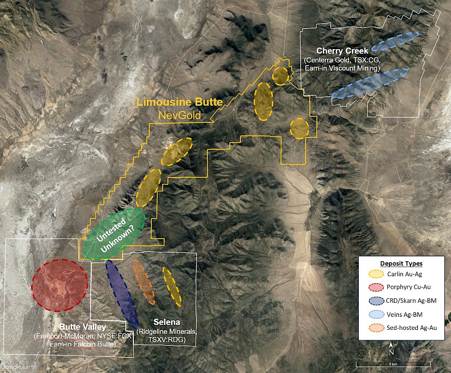
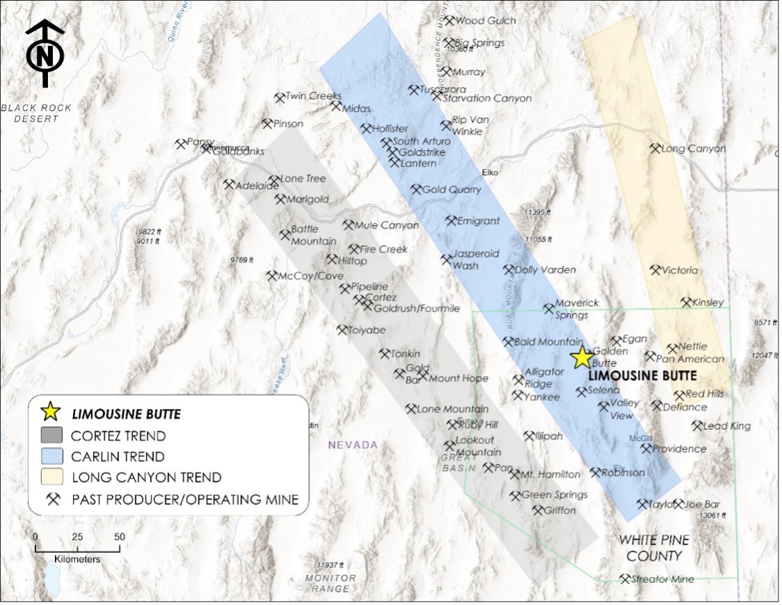
Limo Butte
The technical information contained on this page has been reviewed, verified, and approved by Derick Unger, CPG, VP Exploration of NevGold. Mr. Unger is a "Qualified Person" as defined by National Instrument 43-101, Standards of Disclosure for Mineral Projects.
History
The Limousine Butte Project has a long history of exploration activity dating back to the 1940’s and 50’s when the area was explored for antimony leading to the discovery of gold mineralization at Golden Butte and later Resurrection Ridge. During the years 1997 to 2019 McEwen and its predecessor US Gold (Previously Nevada Pacific Mining) compiled the historical data including extensive geologic mapping, soil and rock geochemical sampling, geophysical programs, and drill data into a digital database. The historical drilling of 887 holes including both RC and core holes totalling approximately 120,000 meters is included in the database.
Historical mining was conducted on the eastern flank of the Cherry Creek Range since gold was discovered in Egan Canyon in 1861. Producing a small amount of gold, and later silver, the district became known as Gold Canyon. In 1872, silver, and later tungsten, deposits were discovered a few kilometers north in Cherry Creek Canyon, where the Cherry Creek district was organized. Larger production from Cherry Creek caused the Gold Canyon district to be included in the former. Mining activity decreased in 1884, but continued through 1958. In total, 1.5 million ounces of silver and 32,000 ounces of gold were produced from the district over that period (Hose et al., 1976).
Silver King, and Pacific Silver, Amselco, Teck and Chevron began exploration in the Golden Butte area in the mid-to-late-1970’s. Their early efforts involved geochemical sampling, geologic mapping and drilling. The claims explored by these companies became the Golden Butte property, which was wholly owned by the Alta Bay Venture (ABV) by the mid-1980’s.
ABV began mining activity at Golden Butte with pre-stripping operations in July, 1988. The first bar of gold was poured in June, 1989 (Armbrust et al., 1989). Mining continued until 1990. The leach pads and collection ponds were reclaimed in 2004 and 2005.
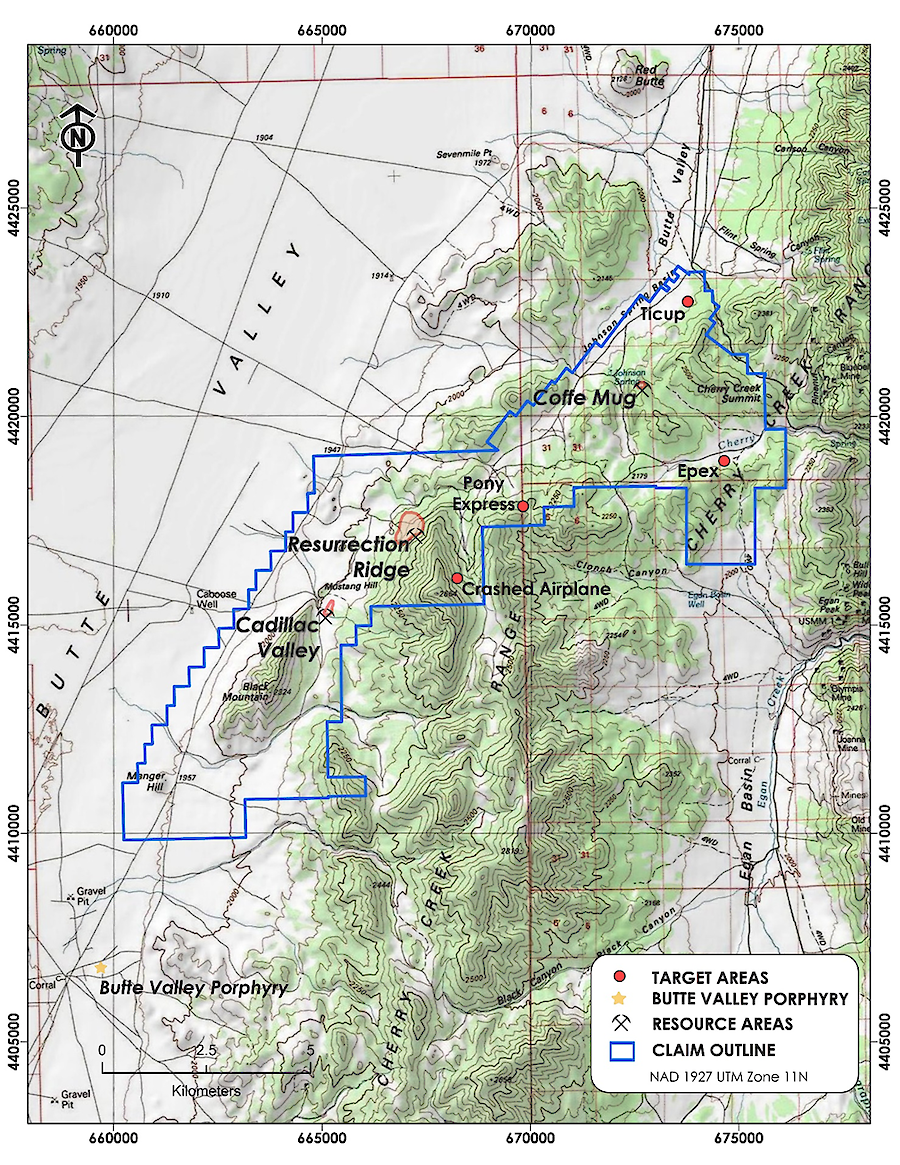
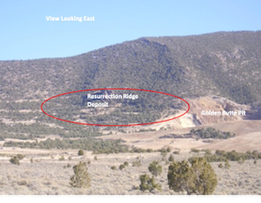
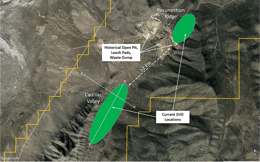
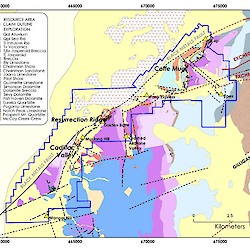
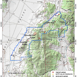
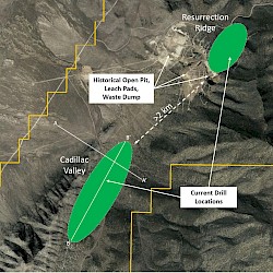
US Gold, McEwen’s predecessor contracted Telesto to undertake the preparation of a Technical Report on the Limousine Butte property in 2009. The aim of the report was to focus on the three primary exploration areas within the larger Limousine Butte property. Specifically this included Resurrection Ridge/ Golden Butte, Cadillac Valley and Coffee Mug. The result of Telesto’s resources estimation is presented in the Historical Resource section.
Location

Geology
The deposits of the Limousine Butte Project are Carlin-type deposits, sediment-hosted, with disseminated gold. Gold is commonly micron-sized, and is associated with hydrothermal alteration of carbonate host rocks. Alteration commonly consists of removal of carbonate and addition of silica. Trace elements associated with Carlin deposits include arsenic (As), antimony (Sb), mercury (Hg), thallium (Tl) and barium (Ba).
The Limousine Butte Project is located within the Basin and Range physiographic province of east-central Nevada. Paleozoic rocks deposited as sediments on the continental shelf, on what was then the western edge of North America and was later covered, and intruded, by Tertiary volcanic rocks.
Compressional faulting of the region during the Cretaceous and early Tertiary Sevier and Larminde orogenies resulted in the formation of generally north-south trending folds and thrust faults.
The Great Basin topography of the region is a result of crustal extension during the middle Tertiary forming the current north-south trending mountain ranges separated by alluvium-filled valleys. The mountain ranges consisting of Precambrian to Mississippian-age sedimentary rocks are folded and titled that have been uplifted on steeply dipping normal faults. This Tertiary extension also caused localized volcanism resulting in mafic to felsic flows capping some of the earlier sedimentary rocks.
The Southern Cherry Creek Mountains dominate the project area landscape. The Cherry Creek Mountain Range is underlain by of a package of sedimentary rocks that strikes along the north-south-trending range, and dips to the west at 25-30 degrees. Rocks range in age from the Ordovician Pogonip limestone to the Pennsylvanian Ely Formation. Tertiary jasperoids, volcanic and intrusive rocks also occur, and Tertiary and Quaternary alluvium fills the valleys and low areas.
The sedimentary sequence is overlain by Tertiary rhyodacite tuff and intruded by rhyodacite sills and dikes. These dikes are probably related to the Cherry Creek Stock (32.8-36.1 Ma). A number of small andesite-lamprophyric dikes have been noted in the Limousine Butte area.
Mineralization
Mineralization at Resurrection Ridge and Cadillac Valley is elevated in antimony (Sb), mercury (Hg) and arsenic (As), and is largely contained within silicified host rocks. Mississippian and Devonian calcareous shales have been hydrothermally altered; carbonate has been removed, followed by several stages of silica deposition. Gold was deposited during the latter stages of jasperoid development. Most sulfides have been converted to limonite. However, drill samples and select rock chip samples have contained pyrite, arsenopyrite, cinnabar and stibnite. (Everson et. al, 2005)
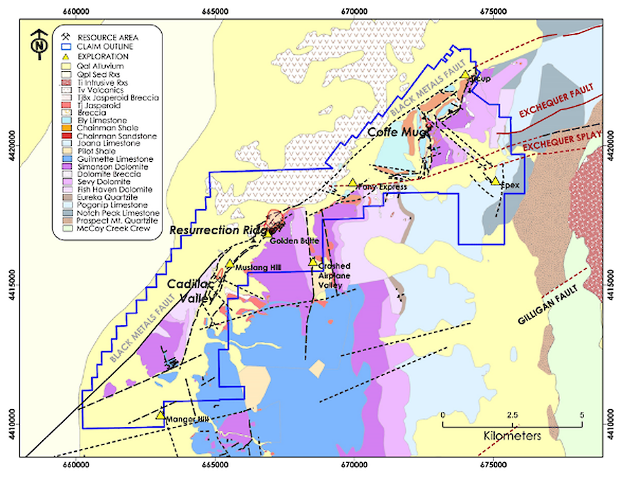
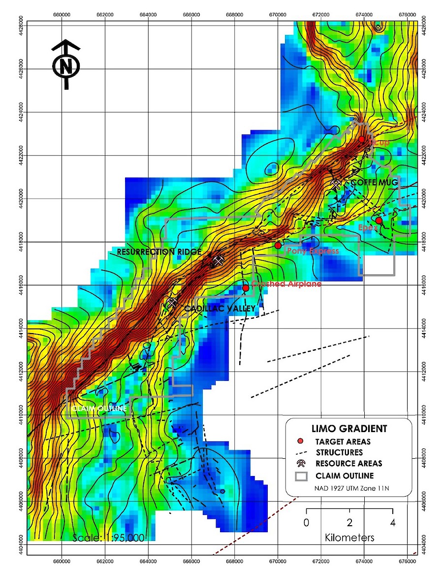
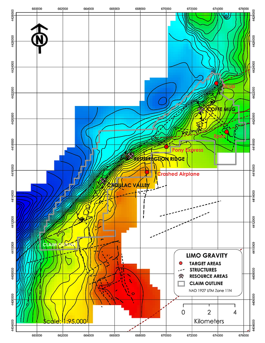
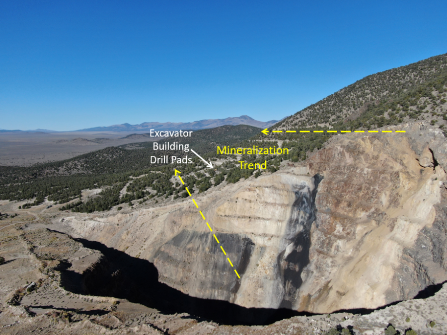
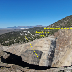
Mineralization is localized where northwest-trending structures intersect previously fractured rock along the northeast-trending Black Metals and Exchequer faults. It is believed that the gold-bearing hydrothermal fluids travelled along the northwest-trending structures. Where the fluids encountered permeable rocks, such as fractured jasperoid, the gold was deposited along fractures. Gold mineralization was preceded by a minimum of two episodes of brecciation and silicification (Armbrust et al., 1989). The mineralized breccia is composed of silicified fragments in a matrix of massive silica. Pyrite is locally present in the matrix with minor stibnite, stibiconite and barite.
Early Jasperoids occurring along the NE zones are offset by NW trending faults creating channel ways for mineralization within in the heavily fractured siliceous rocks. The distribution of the jasperoids can be seen to lie at the intersections the NE-trending Exchequer and NW-trending faults. At the intersection of the two fault trends, alteration and mineralization is strongest. Brittle jasperoid within the faults is strongly fractured, rendering it highly permeable to mineralizing fluids. Ductile rocks (shale) between the two faults are locally argillically altered and intensely deformed. Some of the ductile rocks contain abundant carbonaceous material (Armbrust, et al., 1989). A northwest- trending fault forms the southwest boundary of the Golden Butte deposit.
Historical 2009 Resource
Limousine Butte's Historical Mineral Resource Estimate information is extracted from a report titled "NI 43-101 Technical Report for the Limousine Butte Project, White Pine County, Nevada" with an effective date of July 1, 2009. NevGold considers the 2009 NI 43-101 mineral resource estimate as an Historical MRE that is both relevant and reliable in the context of the data and analysis tools available at that time. A NevGold Qualified Person has not done sufficient work to classify the Historical MRE as a Current MRE for purposes of NevGold disclosure. Further drilling and geological work will be required before the Historical MRE can be classified as a Current MRE for NevGold disclosure.
Resource Area
Category
Tonnes
(000’s)
Au g/t
Au Oz
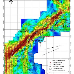
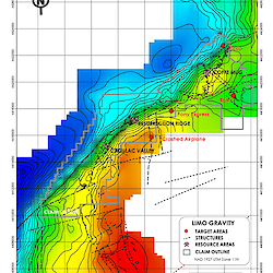
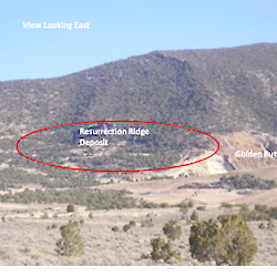
Resurrection Ridge
Measured
5,874
0.891
168,350
Resurrection Ridge
Indicated
2,263
0.477
34,730
Cadillac Valley
Indicated
1,442
0.827
38,000
Total M & I
M & I
9,579
0.784
241,080
Coffee Mug
Inferred
2,255
0.699
50,700
Figures

Register to receive news via email from NevGold Corp.
* Required FieldsForm not found